Application Overview
Rediscover your DJI© flights with unmatched precision. Specifically designed for DJI© drones, Flight ReLive is an open-source project that redefines flight analysis and visualization. Independent from the drone itself, it only requires a video and its subtitle file to deliver an immersive and technically rich experience.
landscape_2 Realistic 3D Visualization
- Accurate reconstruction of the drone’s path within a dynamic and realistic 3D topography.
- Smooth and intuitive navigation across multiple viewpoints, from the 3D scene to integrated charts.
- Dynamic scene reconstruction based on the video’s geographic location and timestamp.
bar_chart Enriched Technical Data
- Full access to DJI© flight data: speed, altitude, GPS position…
- Visualization of camera settings: ISO, exposure, shutter speed, zoom level…
prompt_suggestion Flight Export / Sharing
- Export, share, and reimport your drone flights in seconds — just a file or a simple code.
laptop_mac Available Platforms
Available on Windows and macOS (Intel / Apple Silicon).
No subscription, no ads, no data collection.
A simplified process, designed for efficiency.
Flight ReLive directly imports your drone videos, wherever they are stored on your computer. Once imported, they are fully integrated into the application's library and no longer depend on the original files.
No drone connection or third-party software is required: a single video accompanied by its subtitle file is enough to dynamically recreate the 3D world.
A MapTiler account is required to download the map data — a free account is more than enough to enjoy all features.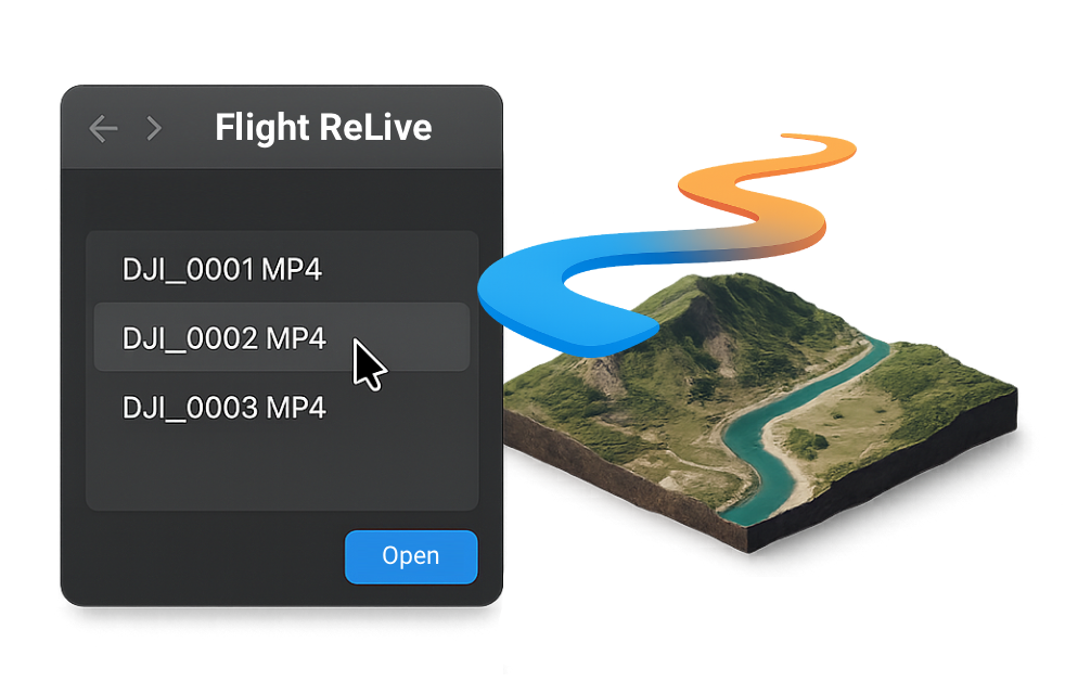
See (and relive) differently.
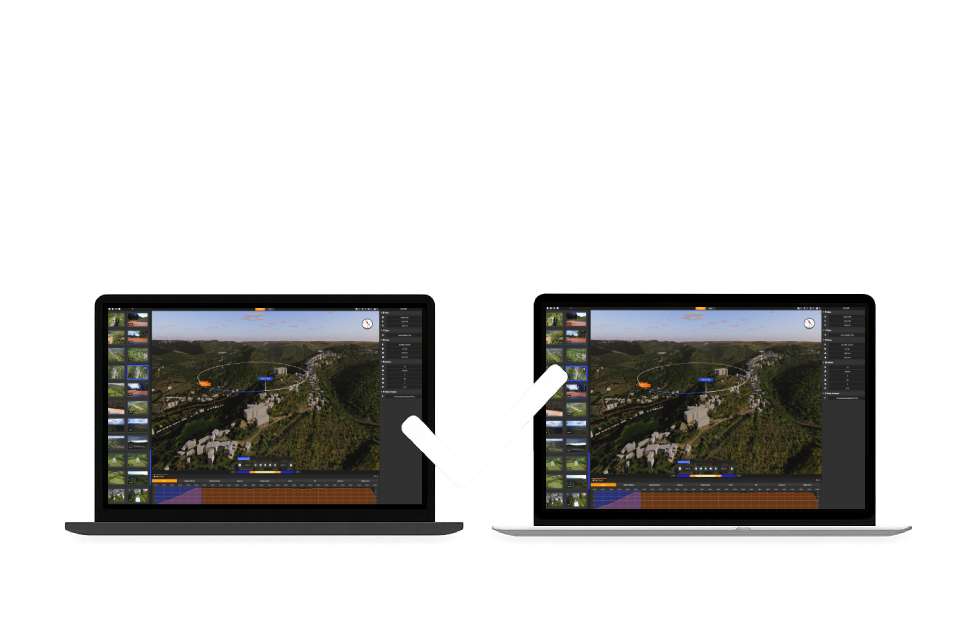
Through this comparison, Flight ReLive reveals its ability to transform a simple video into an immersive 3D environment — no settings or technical knowledge required. A new way to relive your drone flights.
Attendez que ce contenu entre dans le viewport.Community sharing of your flights.
Flight ReLive offers an intelligent sharing mode: with a simple code, your flights can be replayed in one click by any user.
No need to transfer large files or install anything — just copy and paste the code to instantly access the full experience. Perfect for publishing online or sharing your missions with friends, colleagues, or your community.Comprehensive analysis at a glance.
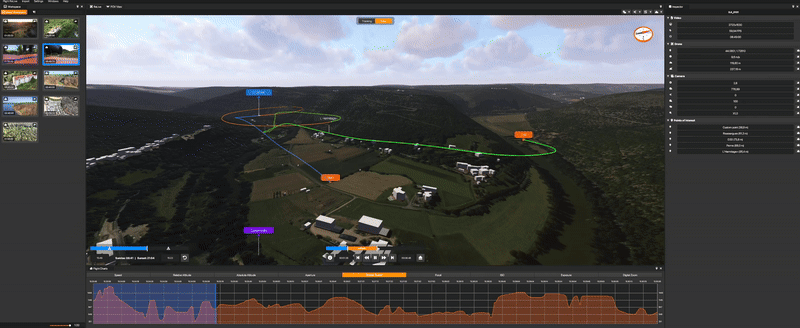
Flight ReLive offers a full range of dynamic charts, perfectly synchronized with the flight scene. Explore each piece of data in real time — speed, altitude, GPS position, camera settings… everything is there, readable and accessible in an instant through smooth and intuitive navigation.
Each flight becomes a visual and analytical experience — clear, immersive, and precise.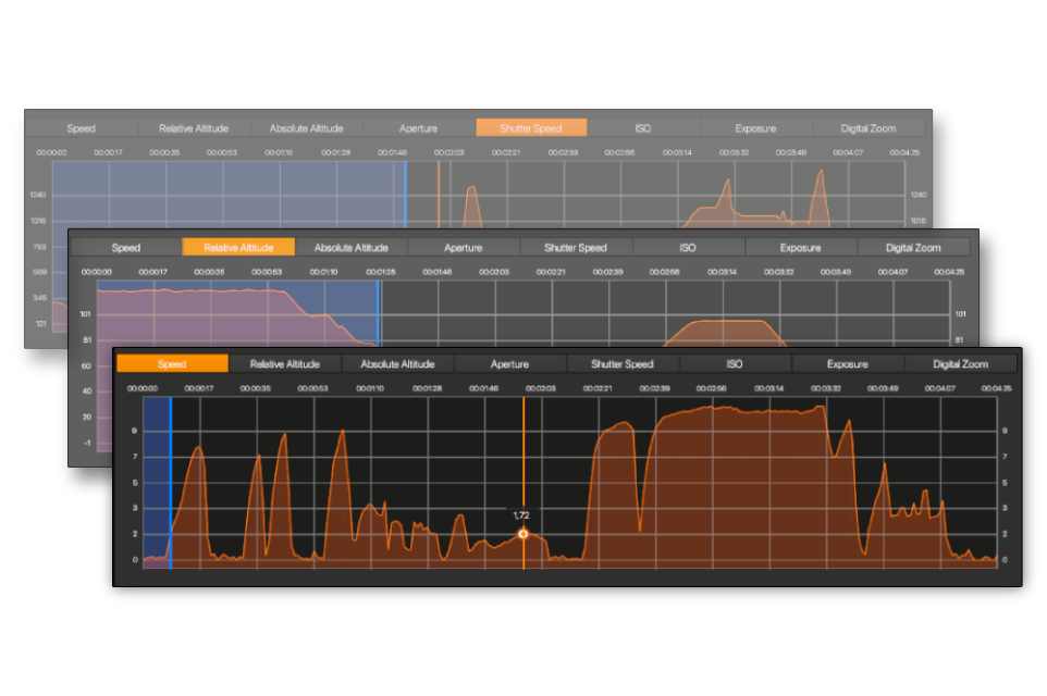
Day / Night cycle.
Flight ReLive includes a dynamic day/night cycle that automatically adjusts the lighting of the 3D scene according to the flight time. Whether you explore landscapes in daylight, at dawn, or at dusk, the visual atmosphere adapts to accurately reflect real conditions. This system also allows you to relive your flight at another time of day, to appreciate every nuance under a different light.
Attendez que ce contenu entre dans le viewport.Expanding DJI compatibility.
Flight ReLive is entirely dedicated to the DJI ecosystem. Although not all models are supported yet, compatibility is expanding rapidly with each new version.
With every update, new drones are tested, integrated, and optimized to ensure faithful playback of videos and metadata from across the DJI lineup.
The compatibility catalog grows day by day, offering an increasingly complete and universal experience for DJI pilots.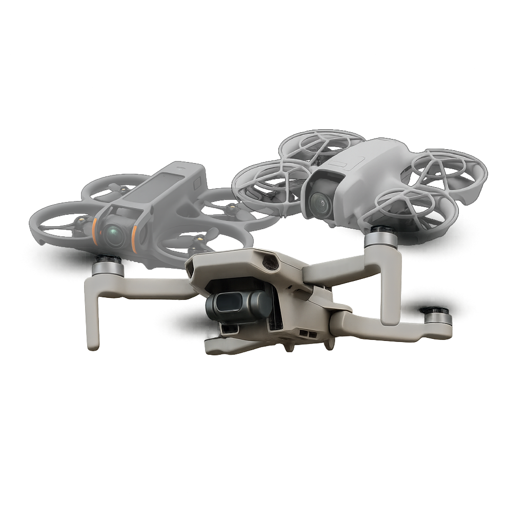
A smooth experience, everywhere.
Flight ReLive works identically on PC (Windows) and macOS (Intel / Apple Silicon), without compromise. The software has been optimized to provide a smooth experience, even on modest configurations.
More in detail.
Select an interface element to learn more.
Click on an element in the image to display detailed information about it.
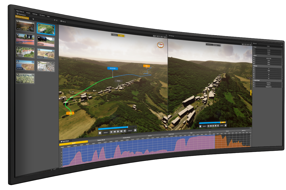
Data synchronized in real time.
Every second of your flight comes to life through perfect synchronization between the 3D modeling and embedded data. Altitude, speed, GPS position, satellite count, and all camera settings (ISO, exposure, aperture, shutter speed, zoom…) evolve in real time. Flight ReLive lets you visualize precisely what your drone saw, felt, and recorded at every moment of the flight.
Synchronized charts.
Explore the data extracted directly from your flight: speed, altitude, calculated relative altitude, as well as all onboard camera parameters (ISO, exposure, aperture, shutter speed, digital zoom…). Each chart is perfectly synchronized with the 3D reconstruction of the path, providing a smooth, precise, and immersive analysis of your flight.
Your centralized flight management space.
The Flight ReLive library gathers all your imported flights, ready to be explored at any time. Each video is analyzed, converted, and stored internally, independently of the original files. Once imported, your flights remain accessible, organized, and secure — without depending on their initial location on your computer. Flight ReLive thus ensures a smooth, reliable, and fully controlled experience.
Realistic 3D modeling of the flight.
The 3D scene is the heart of Flight ReLive. It faithfully reproduces the flown landscape, terrain relief, and the complete drone path in space. Through the 3D path, you can select any point of the flight and instantly access all associated data: speed, altitude, GPS position, camera settings, and much more. Every movement is synchronized with the graphics, for total immersion. Visual effects, display options, satellite textures, buildings… everything is designed to offer a precise, fluid, and spectacular re-experience of your flight.
List of points of interest.
Points of interest (POI) are automatically detected based on your flight position. They highlight key places without manual intervention. On the map, POIs are displayed dynamically according to proximity, making visual exploration and rediscovery of flown areas easier. A direct link to OpenStreetMap lets you explore potential new flight spots in one click — revealing details you may have missed during your first pass.
Dynamic lighting adjustment.
Flight ReLive integrates a dynamic day/night cycle that automatically adjusts the lighting of the 3D scene according to the flight time. Whether exploring landscapes in daylight, at dawn, or at dusk, the visual ambiance adapts to reflect real conditions. This system also allows you to relive your flight at another time of day to appreciate each nuance under a different light.
Global timeline bar.
The global timeline bar lets you easily navigate through your entire flight. At a glance, you can see progress, move from one flight point to another, and access any moment quickly. This feature is synchronized with the 3D scene and charts, offering a smooth and intuitive experience to revisit every moment of your aerial adventure.
- Windows
 1.25.11.1
 - MacOs (Intel)

 1.25.11.1
 - MacOs (Apple Silicon)1.25.11.1
Want to support my work? Head over to Tipeee to make a donation and help me go even further.
There's no shortage of ideas for improving this project, and with your help, we can create an app that's useful to everyone.